TopoMiller
🇺🇸 US Coverage: High-Resolution 1m & 10m DEM Data
TopoMiller uses ultra-high resolution 1m DEM data when available for small regions (under 100 km²).
Great News: Approximately 70-80% of the continental US now has 1m DEM coverage! TopoMiller automatically uses 1m DEM for regions smaller than 100 km² (about 10km × 10km). Larger regions automatically use high-quality 10m resolution data.
🤔 What's the Difference: 1m DEM vs. LiDAR?
📊 LiDAR (Raw Data)
A giant 3D scatter of points - billions of laser measurements showing the tops of trees, buildings, cars, and the ground. Super detailed, but messy and hard to use without special software.
🗺️ 1m DEM & 10m DEM (What TopoMiller Uses)
Clean elevation maps of the ground only. 1m DEM: Ultra-high resolution (1 meter per pixel) from LiDAR where available. 10m DEM: High quality standard resolution (10 meters per pixel) from USGS. Trees, buildings, and clutter are removed - just the "bare earth." Easy to use for maps, analysis, and CNC carvings.
🗺️ Current 1m DEM Coverage Map
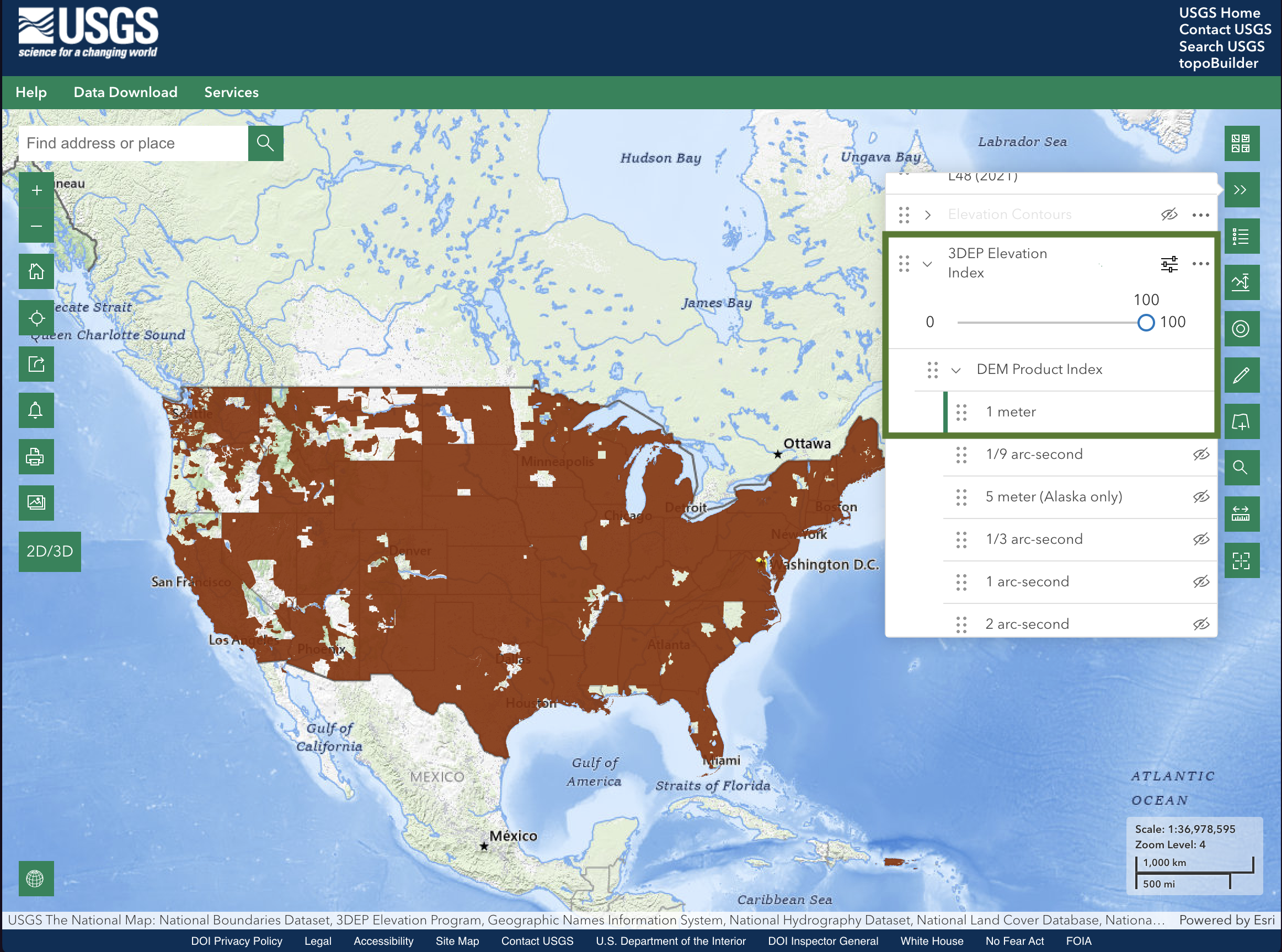
Brown areas show where 1m DEM data is currently available (Source: USGS 3DEP)
📈 Coverage Expanding
The USGS is actively working toward 100% coverage by 2028. New survey data is added regularly, so coverage continues to improve!
🔍 Check If Your Area Has 1m DEM Coverage
Official USGS Coverage Map
The USGS provides an interactive map to check exactly where 1m DEM data is available:
👉 Open The National Map ViewerHow to check your area:
- Click the link above to open The National Map
- Search for your location or pan/zoom to find it
- On the right, choose the "Layers" icon, second from the top
- Expand "Elevation Products (3DEP)" and check the "1 meter DEM" layer
- Areas with coverage will show colored polygons ✅
Or Just Try It in TopoMiller
TopoMiller automatically detects and uses 1m DEM data when available:
- Go to the Generate page
- Select your region (keep it under 100 km² for 1m resolution)
- Click "Generate 3D Preview"
- If 1m DEM is available, you'll see exceptionally detailed terrain
💡 Tip: Most areas in the US now have 1m DEM coverage! If your area happens to be in an uncovered region, TopoMiller automatically falls back to high-quality 10m elevation data, which still produces excellent CNC carvings.
📊 Resolution Comparison
| Resolution | Detail Level | When Used |
|---|---|---|
| 1m DEM | Fine terrain detail and small features | Regions under 100 km² with coverage |
| 10m DEM | Major terrain features, ridges, valleys clear | Large regions or fallback |
Example: For a 10km × 10km area:
- 1m DEM: 100 million elevation points - crisp detail you can almost touch
- 10m DEM: 1 million elevation points - still excellent quality for CNC
Both produce beautiful CNC carvings - 1m DEM just captures finer terrain features!
🌍 Coverage is Expanding
The USGS is actively surveying the entire United States:
- 2025: ~70% coverage
- 2026: ~85% coverage
- 2028: 100% coverage goal
Priority areas include flood zones, wildfire risk areas, and national parks.
Questions? Visit the USGS 3DEP Program for more information about DEM data coverage.